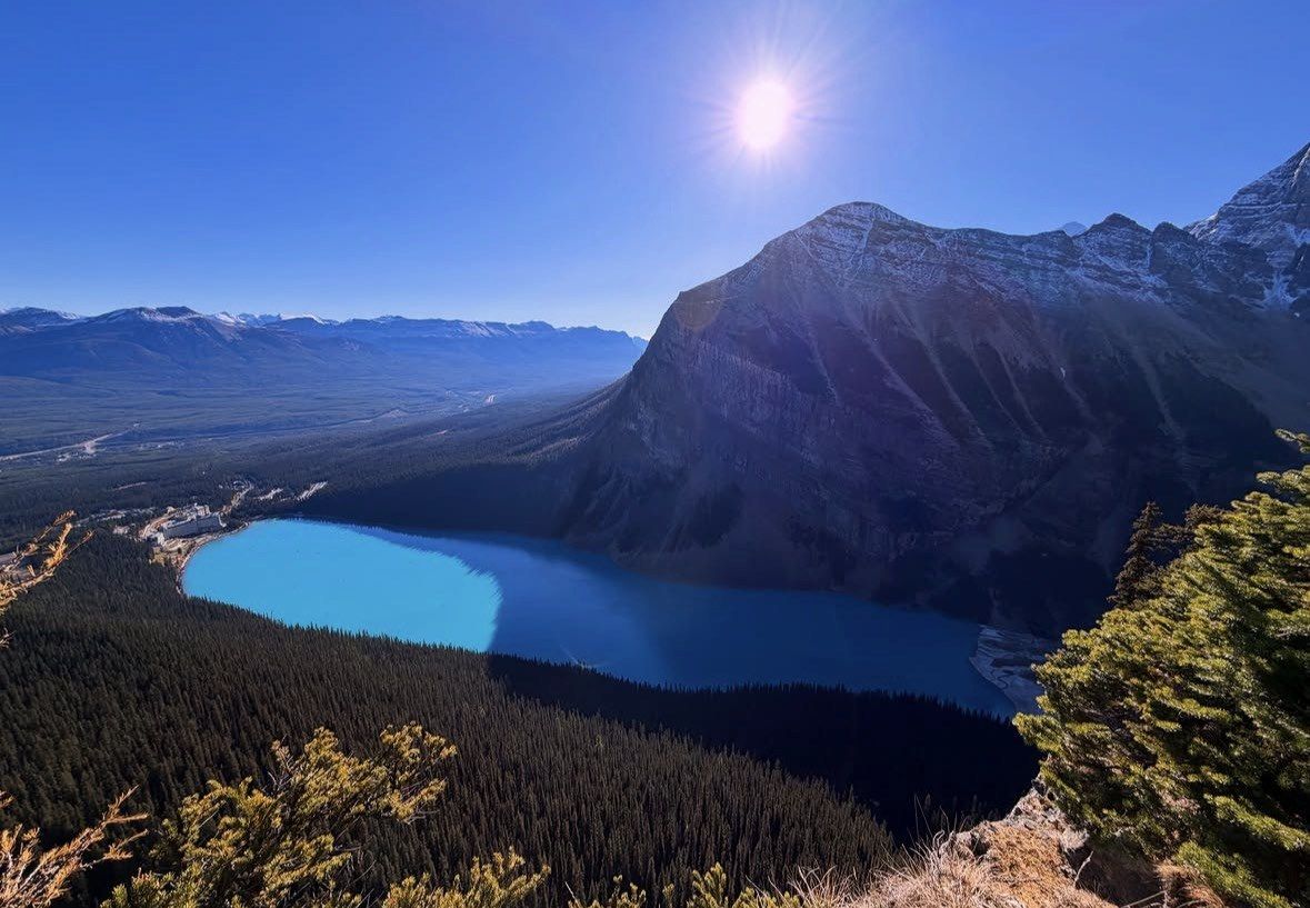
In shortPeyto Lake is viewed from a lookout at Bow Summit, 2,088 m, the high point of the Icefields Parkway, which Parks Canada places 43 km north of Lake Louise. A paved path reaches the platform in about 10 minutes from the car park. The blue comes from rock flour ground off by the Peyto Glacier, and the viewpoint is listed as accessible in every month of the year.
43 kmnorth of Lake Louise
2,088 mBow Summit elevation
about 10 minutespaved walk to lookout
232 kmparkway to Jasper
Peyto Lake from Lake Louise: the drive and the walk
Parks Canada places the Bow Summit and Peyto Lake viewpoints 43 km north of Lake Louise on the Icefields Parkway, while Banff & Lake Louise Tourism gives the distance as 46 km; take the official figure as your planning number and watch for the signed turn-off on the day. No official drive time is published for the stretch, so work from the distance and add margin for stopping traffic in summer. Bow Summit is the high point of the entire road at 2,088 m, which is why you look down on the lake from a shelf of mountain rather than standing at the water.
The walking is minimal. From the car park a paved path reaches the lookout in about 10 minutes, and there is a drop-off point in the upper parking lot for visitors with limited mobility. In winter the same approach is quoted at 1.5 km return with 25 m of gain and around 45 minutes.
There is no shoreline access in any of this. The lake lies far below the platform, fed by meltwater from the Peyto Glacier, and the whole stop is a viewpoint rather than a lakeside walk.
- Parks Canada: Bow Summit and Peyto Lake viewpoints, 43 km north of Lake Louise
- Bow Summit elevation 2,088 m, highest point on the Icefields Parkway
- Car park to lookout: a short paved path of about 10 minutes
- Upper parking lot drop-off for visitors with limited mobility
- Winter version of the walk: 1.5 km return, 25 m of gain, about 45 minutes
Three lakes and Yoho, with the parkway stop in the off-season window
Between October 12 and May 31, when Moraine Lake is out of reach, this 8 to 11 hour day trip from CAD 88 includes admission to Marble/Johnston Canyon or Peyto Lake with the ticket and puts a local guide in the driver's seat for the drive.
★ 4.8/5 · 533 reviews
Light, crowds and snow at the lookout
The hour you arrive decides what you see. Suspended rock flour refracts sunlight, and the shade shifts with the light through the day, so a morning stop and an afternoon stop on the same date do not look the same. Midday is also when the car park works hardest: May to October is the peak season on this corridor and the crowds are heaviest from June through October, so arrive early on the drive north or save the stop for the way back late in the day.
At 2,088 m you are more than 300 m above the Lake Louise shoreline, and it stays colder and windier than the valley. Snow can fall on high ground at any time, including July, alpine hiking season does not begin until late June, and in April snow is still common higher up. The valley averages give you the baseline only: 17 C by day and 3 C overnight at Lake Louise in June, 15 C and 0 C in September, 8 C and minus 5 C in October. Bring a wind layer even in August.
Wildlife turns up along the parkway, often at the roadside. Parks Canada requires 100 metres of distance from bears, wolves, cougars and coyotes and 30 metres from deer, elk, sheep and moose, and feeding, luring or disturbing an animal is illegal with penalties reaching CAD 25,000.
Peyto Lake best time to visit
Travel Alberta promotes Peyto Lake as a spring, summer and autumn destination, and that matches how the water behaves. The sediment load arrives in spring and early summer, the glacial lakes then hold their azure through the summer, and the colour you came for is a summer and early-autumn thing rather than a May certainty.
Early summer is the compromise month. June averages 17 C by day at Lake Louise, the parkway is open and quiet compared with July, but snow lingers on high ground and the alpine season proper only starts late in the month. Late September into the first week of October brings larch colour to the Lake Louise area and cold mornings, with October averaging 8 C by day and minus 5 C overnight down at the lake.
Outside the summer months the viewpoint is still listed as accessible every month of the year, and the walk simply becomes the 1.5 km, 45-minute winter version. What changes is everything around it: the road, the services and the daylight.
- April and May: snow still common higher up, sediment only starting to arrive
- June: parkway quieter than midsummer, snow lingering above the road, 17 C/3 C at Lake Louise
- July and August: strongest colour and the busiest car park, 21 C by day at Lake Louise
- Late September to the first week of October: larch colour in the Lake Louise area, cold starts
- November to March: viewpoint listed as accessible, winter walk of 1.5 km return, snow tires or chains required on the parkway
Where the stop sits in a day on the Icefields Parkway
The viewpoint is the natural turning point of a half-day run north, and the second half of a full-day one. Parks Canada's ordered distances from Lake Louise put Bow Lake at 39 km and the Crowfoot Glacier at 36 km, both before the climb to Bow Summit, so you pass two of the roadside classics on the way up. Carry on and the road reaches Lower Waterfowl Lake, Mistaya Canyon and Saskatchewan River Crossing before the glacier country begins.
The full road runs 232 km from Lake Louise to the Jasper townsite, and the Columbia Icefield Centre is 128 km north, which is a long day out and back from Lake Louise. The centre is open May to September and its Glacier Gallery from mid-April to mid-October. The Glacier Adventure onto the Athabasca Glacier is closed for 2026 and returns May 1 to October 11, 2027, taking about 2.5 to 3 hours from the Glacier Discovery Centre, so build that into the plan rather than assuming it on the day.
- Distances as published by Parks Canada, measured north from Lake Louise on the Icefields Parkway
| Stop | Km north of Lake Louise |
|---|
| Herbert Lake | 6 km |
|---|
| Crowfoot Glacier | 36 km |
|---|
| Bow Lake | 39 km |
|---|
| Bow Summit and Peyto Lake viewpoints | 43 km |
|---|
| Lower Waterfowl Lake | 60 km |
|---|
| Mistaya Canyon | 74 km |
|---|
| Saskatchewan River Crossing | 80 km |
|---|
| Columbia Icefield Centre | 128 km |
|---|
Park pass, fuel and winter driving on the road north
A park pass is needed to use the Icefields Parkway, and that holds even if you only drive through without stopping; the same applies to the Bow Valley Parkway. Sort it out before you point the car north rather than at a gate halfway up.
Services are thin. There is no cell coverage on the parkway, most roadside services run in summer only, and Saskatchewan River Crossing, 80 km north of Lake Louise, is the single fuel, washroom and restaurant stop on the Banff section. Fill up and fill bottles in the village before you leave.
Winter driving has its own rules. To climb to Bow Summit between November 1 and March 31 your car needs snow tires or chains, as it does at any point in the year when the surface is snow or ice covered, and commercial vehicles over 4,550 kg are barred from the road entirely. Plowing happens only in a 7 am to 3:30 pm window, so a late start to the lookout can mean driving back down an unplowed surface, and since the 230 km between Lake Louise and Jasper carries no winter services at all, the 43 km up to Bow Summit is about as far north as a short December day sensibly goes.
Who should make the trip north
Drive north if you have a full day free, settled weather and the colour matters to you. From June through early October the stop gives you a 10-minute walk, a view from 2,088 m and two more roadside lakes on the way, which is a far better return on a day than queuing twice at the Lake Louise shoreline. Go in the first hours of the day or late in the afternoon.
Skip it if your schedule is one day for Lake Louise and Moraine Lake, if the forecast is low cloud, or if you are travelling on a short winter day without snow tires or practice on winter roads. The view is from a high shelf at 2,088 m, and in low cloud you see none of it.
If you would rather not drive the parkway yourself, two options on this site cover the road. The Lake Louise Moraine Lake Emerald Lake Yoho Banff National Park day trip runs 8 to 11 hours from CAD 88, rated 4.8 ★ (533 reviews), in an air-conditioned van with a local guide as driver, and between October 12 and May 31 admission to Marble/Johnston Canyon or Peyto Lake comes with the ticket, with a choice of Banff Avenue or Bow Falls as the last stop. The Lake Louise, Moraine Lake and the Icefields Parkway Full-Day Tour is 8 to 9 hours from CAD 220, rated 4.9 ★ (965 reviews), with a driver and tour guide, transport by private vehicle and pickup and drop-off from designated meeting points. Each of the two leaves you until 24 hours before the scheduled departure time to cancel for a full refund, which is useful on a corridor where the Bow Summit view depends on cloud at 2,088 m.
Questions people ask
Is the Peyto Lake viewpoint open in winter?
Banff & Lake Louise Tourism lists the viewpoint as accessible in every month of the year. In winter the approach is quoted at 1.5 km return with 25 m of gain and about 45 minutes on the paved path, instead of the 10-minute summer walk. Check conditions on the official pages on the day, because the parkway is a high road with limited winter maintenance.
Can someone with limited mobility reach the lookout?
There is a drop-off point in the upper parking lot for visitors with limited mobility, and the route from the car park to the lookout is a short paved path of about 10 minutes. In winter the same path is measured at 1.5 km return with 25 m of gain, so the surface and the distance both change with the season.
Why is the water that colour?
Melting glaciers grind fine rock flour, and the meltwater carries that glacial till into the lake, where the suspended sediment refracts sunlight. At Peyto Lake the source is the Peyto Glacier. Meltwater delivers most of that sediment in spring and early summer, so the lookout shows its strongest azure once summer is under way, and within a single visit the shade below the platform changes as the light moves.
How far is Peyto Lake from Banff?
Banff & Lake Louise Tourism gives 101 km from the town of Banff and 46 km from Lake Louise, while Parks Canada places the Bow Summit and Peyto Lake viewpoints 43 km north of Lake Louise. Beyond the viewpoint the Icefields Parkway continues for a total of 232 km from Lake Louise to the Jasper townsite, so this stop is only the first stretch of the road.
Read also