In shortParks Canada lists the plain of six glaciers hike at 5.9 km one way, 595 m of gain and 250 m of loss, moderate, about 4 hours return from the Lake Louise shoreline. The teahouse near the end is listed open 9 a.m. to 5 p.m. in its summer season and takes cash only. Linking it over the Beehives to Lake Agnes makes a loop of about 14.5 km.
5.9 kmone way, Parks Canada
595 mof elevation gain
about 4 hoursround trip, moderate
14.5 kmfull two-teahouse loop
Plain of six glaciers hike: distance, climb and time
Parks Canada measures the trail at 5.9 km one way with 595 m of gain and 250 m of loss, rates it moderate and allows about 4 hours for the round trip. That is the figure to plan from. Banff & Lake Louise Tourism publishes a different set for the same walk, 11 km return with 360 m of gain in 3 to 4 hours, so check the trail report on the day rather than assuming the shorter version applies to you.
The gradient is the easy part of this route. What catches people is the length: almost 6 km of walking before you turn around, on a trail that starts flat along the water and then climbs steadily for the second half. There is no scrambling in the Parks Canada rating, but there is a lot of time on your feet, and the 250 m of loss means you climb on the way back too.
Treat 4 hours as moving time with no stops. Add the walk out from the Chateau end of the lake, a pause at the teahouse, photographs at the top of the moraine and the trip back to the village, and the honest figure for most people is five to six hours of day. Start walking by 8 a.m. in summer and the whole thing sits comfortably inside daylight.
The walk up the valley beyond the lake
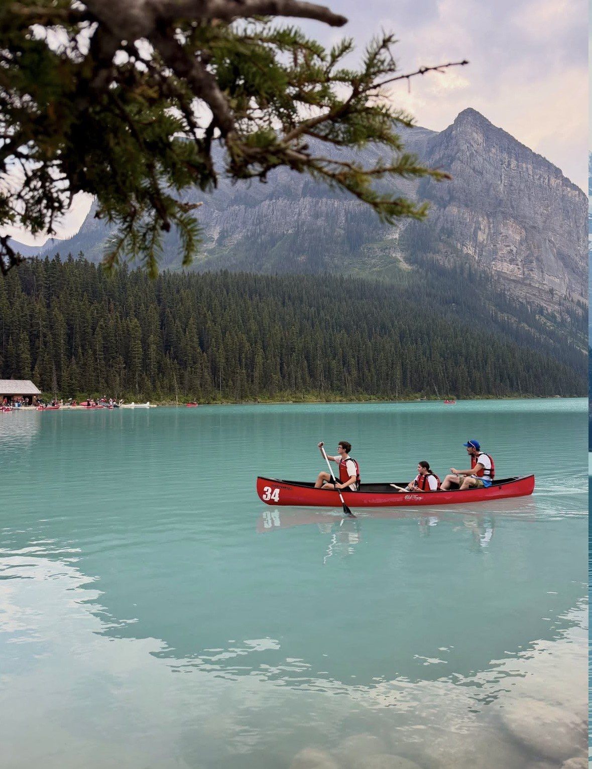
The first stretch is the flat lakeshore path along 2.4 km of water at 1,731 m, and it is busy until mid-morning. Past the far end of the lake the crowd thins quickly, the gravel flats take over and the trail begins to work up the side of the valley on rock and old glacial debris. Underfoot it changes from forest duff to loose stone and moraine, and from there to the end the ground stays rough.
Ahead of you the whole way is the Victoria Glacier, hanging off Mount Victoria, with Mount Lefroy closing the right-hand side of the valley. Those are the features Banff & Lake Louise Tourism names from this trail; the full list of six glaciers is not published by an official source, so do not expect a signboard naming them at the viewpoint.
Beyond the teahouse the path continues along a lateral moraine to the end of the trail, with the icefall and the valley wall in front and the lake a long way back down behind you. This last section is the reason to do the route at all, and it is also where the surface is at its worst and the weather at its most exposed. If cloud has come down and you cannot see the glacier, there is no point pushing on to it.
Plain of Six Glaciers tea house: season, hours and payment
The teahouse was built by the Canadian Pacific Railway in the mid-1920s and it sits near the far end of the trail, short of the final viewpoint. Banff & Lake Louise Tourism lists it open daily 9 a.m. to 5 p.m. through its summer season, which is worth confirming on the day because no official opening hours are published for the building.
On the season, Parks Canada is the source to trust: both teahouses above Lake Louise open in mid-May and close after Canadian Thanksgiving in mid-October. The tourism board gives a narrower June to October window for the same two buildings. Either way, an early-season visit can mean snow on the upper trail even when the valley is dry, and the last days before Thanksgiving are the end of it.
Bring cash. The teahouse takes no cards and no digital payments, and at that distance from the village there is nothing to fall back on.
- Season: mid-May to shortly after Canadian Thanksgiving in mid-October, according to Parks Canada
- Hours: listed by the tourism board as daily 9 a.m. to 5 p.m. in summer
- Payment: cash only, in Canadian dollars, at the counter
- Why the counter is shut from November to mid-May: Parks Canada considers the teahouse hikes unsafe in that period because of avalanche risk, and a signposted winter track up here is no guarantee of safe ground
Linking the valley with the Beehives and Lake Agnes
The circuit joins the two teahouse valleys by crossing high ground between them, and from the Chateau it comes to about 14.5 km. Walked that way you get the glacier views from the valley, the climb over the Big Beehive with Lake Louise directly below the cliff edge, and Lake Agnes on the way down. It is a full day and it needs settled weather, because the high section between the two valleys is the part you cannot shorten once you are on it.
What you are adding to the valley sits in the Parks Canada list under the neighbouring drainage: 3.9 km one way and 495 m of gain to Lake Agnes, moderate at 2.5 to 3 hours return on its own, plus a 1.5 km spur from Lake Agnes to the Big Beehive with 150 m of gain and 115 m of loss. The connector between the Lake Agnes Tea House and the Big Beehive is listed by the tourism board at 1.6 km. Climbed as a destination rather than as a link in a circuit, the Big Beehive carries a difficult rating from the tourism board at 5.4 km one way, 731 m of gain and 4.5 to 5 hours return, which is a fair measure of what the high ground costs you late in the day.
The Devils Thumb, the rock tower above Lake Agnes, comes up constantly in trip reports and has no distance, ascent or time in the official hiking list. Leave it out of the plan for a circuit day. Adding an unmeasured steep extra to a 14.5 km loop is how people end up descending in the dark.
Fitness for the full loop means being able to climb 595 m in one valley, then regain height over the Beehives, then walk out, in one go. If 495 m of continuous gain on the Lake Agnes trail is already your limit, do the valley as an out-and-back instead and keep the Beehives for another trip.
| Route | Distance | Climb | Time | Listed by |
|---|
| Plain of Six Glaciers to the teahouse and trail end | 5.9 km one way | 595 m up, 250 m down | about 4 h return, moderate | Parks Canada |
|---|
| Plain of Six Glaciers, alternative figures | 11 km return | 360 m | 3 to 4 h | Banff & Lake Louise Tourism |
|---|
| Lake Agnes Tea House | 3.9 km one way | 495 m | 2.5 to 3 h return, moderate | Parks Canada |
|---|
| Big Beehive spur off the Lake Agnes trail | 1.5 km | 150 m up, 115 m down | not published | Parks Canada |
|---|
| Big Beehive as its own hike | 5.4 km one way | 731 m | 4.5 to 5 h return, difficult | Banff & Lake Louise Tourism |
|---|
| Lake Agnes Tea House to Big Beehive connector | 1.6 km | not published | not published | Banff & Lake Louise Tourism |
|---|
| Full circuit over the Beehives linking both teahouse valleys, from the Chateau | about 14.5 km | not published | full day | Banff & Lake Louise Tourism |
|---|
Lake views without the long valley day
If the 5.9 km each way is more than your trip has room for, this 8 to 10 hour day trip from CAD 79 covers the transfer from Banff, Canmore or Calgary and the Moraine Lake permit and access fee, with a lunch stop at Lake Louise Village.
★ 4.9/5 · 1,602 reviews
Timing, weather and when to turn back
An early start is the single thing that makes this day work. The service that puts you on the shoreline early is seasonal: in 2026 the Parks Canada Lakeshore shuttle operated from May 15 to October 12, leaving the Park and Ride at half-hourly intervals between 6:30 am and 5 pm, with the final run back at 7:30 pm, which is the outer edge of a four-hour hike that also includes a teahouse stop. Every seat has to be reserved in advance, and nothing is sold to hikers who arrive on spec. For 2027 the dates were still unpublished when this page was written, so look them up on the official pages before you build a hiking day around them. Roam Route 8X runs daily through the year between downtown Banff, Lake Louise Village and the lakeshore, a ride Roam puts at about 1 hour 20 minutes, which a Banff base pays at both ends of the day.
Set a turnaround time before you leave the shoreline and hold to it. Work backwards from the last bus of your chosen service, subtract the descent, subtract the transit leg if you are coming from Banff, and whatever hour that leaves is your limit at the high point. Miss the last Parks Canada shuttle and getting back to the Park and Ride becomes your own problem.
Weather judgement matters more here than on the shorter teahouse walk. This valley carries its own Parks Canada rating for spring avalanche conditions in May and June, and from November through mid-May the agency puts the teahouse hikes outside what it treats as safe walking. Snow falls on these alpine trails at any time, including July, the month that averages 21 C by day and 5 C overnight at the lake. September cools to about 15 C and 0 C, October to 8 C and minus 5 C, and it is colder again a few hundred metres above the water.
Larch colour peaks from the last week of September into the first week of October, which is also when the trail is at its busiest and the teahouses are within days of closing. Go midweek in that window if you can, and be on the path at first light.
- Alpine hiking season begins in late June, and the upper trail can hold snow well after the valley is clear
- A 21 C afternoon at the water tells you nothing about the moraine at the top, so pack layers and read the trail report before you leave
- The distance rules apply the whole way up the valley: 100 m from bears, wolves, cougars and coyotes, 30 m from deer, elk, sheep and moose
- Offering food to an animal, luring it closer or disturbing it breaks park law, with fines running to CAD 25,000
- When a Group Access restriction is posted for bear activity, you may walk only as a tight party of four or more
Choose the full circuit, the valley out-and-back or a day by the water
Do the full 14.5 km circuit if you are a regular hill walker, you are at the shoreline early, the forecast is settled and you are happy on rough moraine with a long second half. That combination is not common on a holiday day, and the loop punishes a late start more than any other walk above the lake.
The valley out-and-back is the better choice for most fit visitors: 5.9 km each way, 595 m of gain, about 4 hours of walking by the official figures, the same glacier views, the same teahouse, and the option to stop wherever your legs or the weather say so. You can turn around at any point and still have had the valley.
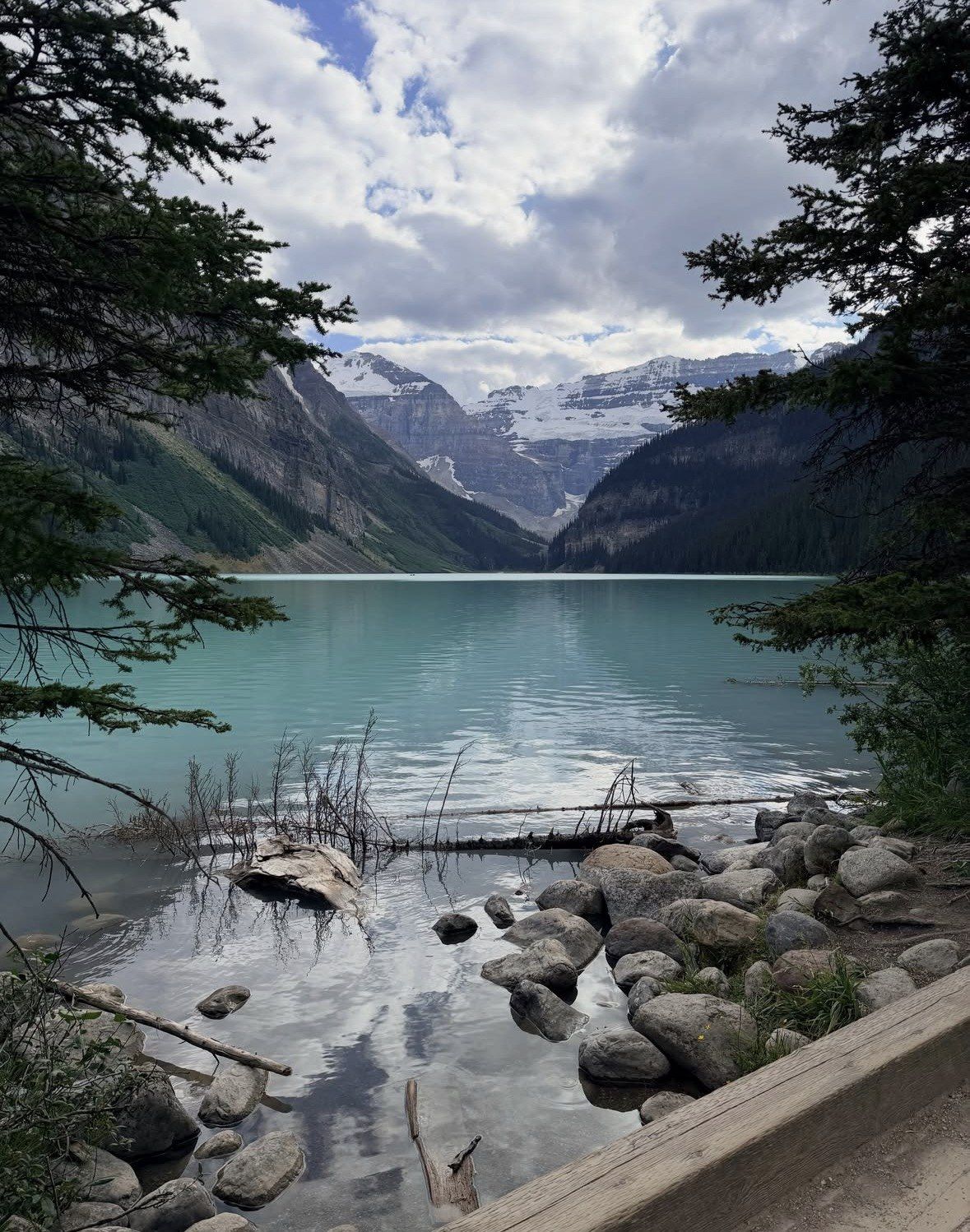
A couple of hours beside the lake is not the same trip, and it is worth being honest about that. A stop that includes the drive up from Banff covers the flat shoreline path, the Chateau end of the lake and the view up the valley to Mount Victoria, with nothing like the time this hike needs. If that is the shape of your day, the tours on this site handle the 62 km from Banff and the 4 km climb from the village in one booking and leave you the hours at the water, with Moraine Lake access inside its own season.
Questions people ask
Is park admission needed to walk to the Plain of Six Glaciers?
Yes. Park admission is required for Banff National Park and is paid separately from any transport ticket. Either a daily pass or the annual Parks Canada Discovery Pass gets you onto the trail, and the daily one holds good until 4:00 pm the following day, so a single purchase can cover a first attempt at the valley and a second early start if the weather turns you back.
Can I do the Plain of Six Glaciers in winter or early spring?
No. From November through mid-May Parks Canada places the teahouse hikes outside safe walking because of avalanche risk, and points out that a route with signs on it has not thereby been judged safe. This valley also carries a spring avalanche rating from the agency covering May and June. The teahouse itself is shut for most of that period.
How does the walk compare with the Lake Agnes trail?
Lake Agnes asks less of you: the Parks Canada entry reads 3.9 km one way, 495 m of gain and 2.5 to 3 hours return, finishing at a teahouse that stands at 2,135 m. Come up this valley instead and it is 5.9 km each way, gaining 595 m and dropping 250 m, roughly 4 hours on the move. Both are rated moderate, so the difference is distance and time rather than difficulty.
Will I see bears on the trail?
It is possible. Around 65 grizzlies are estimated to live in the park, dens empty between late March and mid-May, and the shrub berries ripen from about mid-July to early August, when feeding animals work their way onto slopes like these. Keep 100 m away from any bear, make noise on blind corners, and check whether a group-of-four requirement is in force before you start.
Is there anywhere to buy food or water on the route?
The teahouse near the end of the trail serves visitors through its summer season and takes cash only, with no cards and no digital payments accepted. Outside that season, and before it opens for the day, carry everything you need. Plan on your own water for the full 5.9 km each way.
Read also